Coastal Resilience – An App to Help Wade Through High Water
Virginia’s Leadership in Flood Resilience
January 26, 2017Science Pubs ODU- Following the Flood: Resilience Research in Hampton Roads
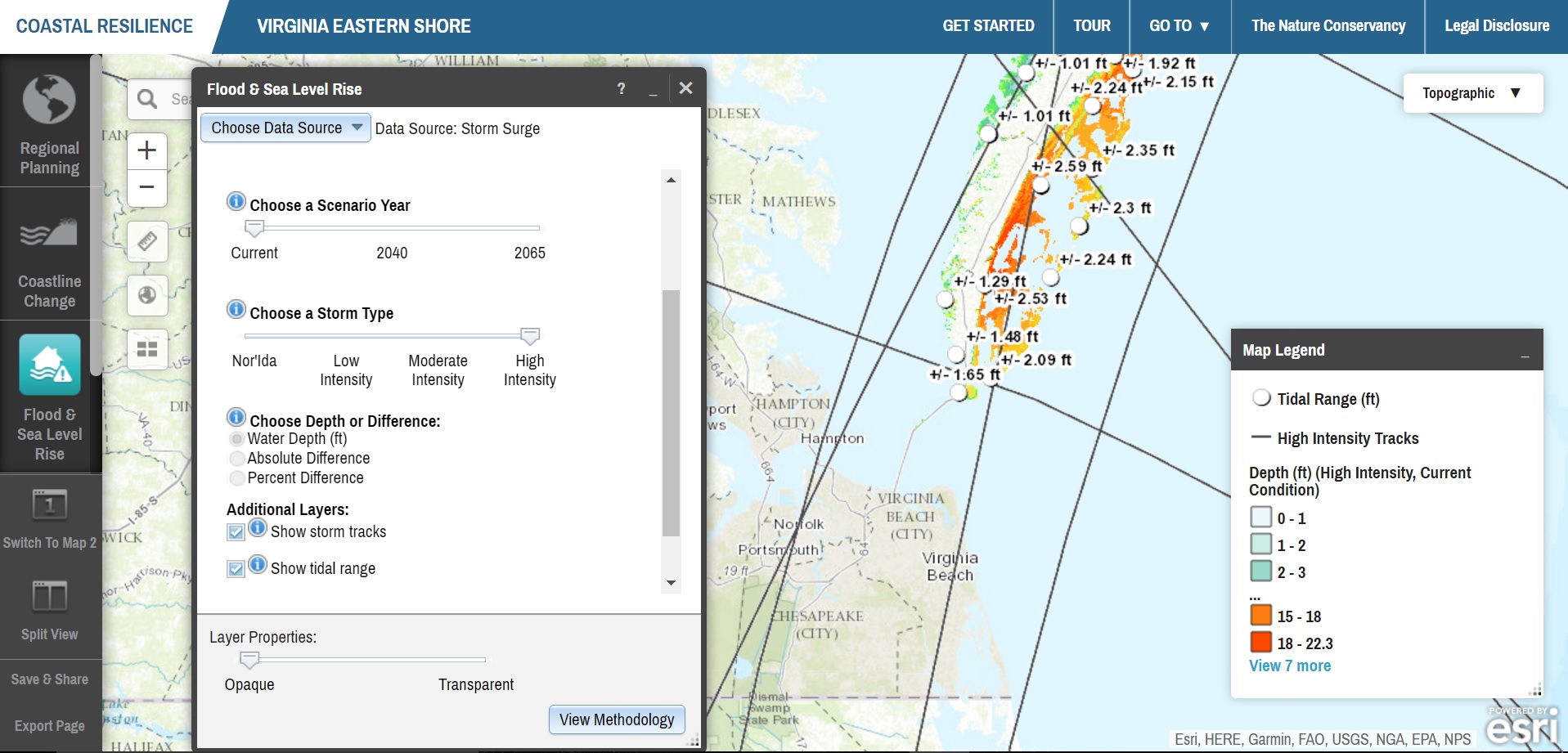
February 15, 2017Coastal Resilience, a long term project designed by the Nature Conservancy, has created an internet tool that can help Virginians track the progress of sea level rise adaptation efforts. The app allows users to create custom maps showing which roads are more likely to flood, and it will also pinpoint any emergency shelters nearby. This tool can allow anyone with a computer or smart phone to plan out several possible routes to consider when driving through future downpours or how to design an evacuation before a hurricane. Another resource will demonstrate how coastal habitats may change over time and track animal migration patterns.
In the Information Age, ordinary people have a wealth on information at their fingertips, and with the help of groups like the Nature Conservancy, the number of resources available on environmental issues will continue to proliferate. The Coastal Resilience project was detailed in more detail in an article by the Virginian-Pilot.